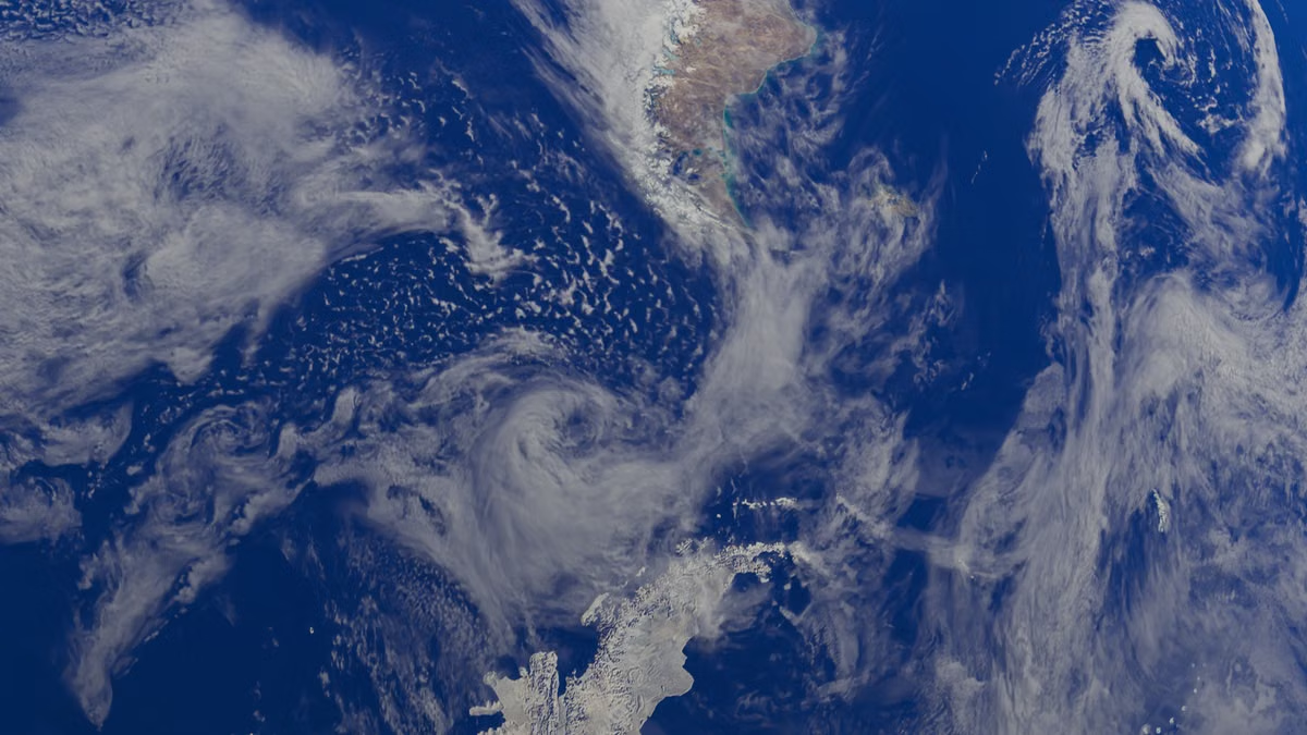
USGS describes Landsat 8 and Landsat 9 as offset in their acquisition timing, producing an 8-day combined revisit cycle; that is a satellite observation schedule, not a promise that every location will have a clear, usable image on each pass (USGS Landsat acquisition information). That distinction points to the answer: a God's Eye View is usually a viewing perspective, not a fixed dataset or a dedicated software product. A scene might use real satellite data, a 3D Earth simulation, or a geographic browsing product such as Google Earth. You need to identify the viewpoint, the underlying data, the rendering method, and the product separately.
This guide is for you if you are trying to identify what a God's Eye View means, assess whether a dramatic image uses real satellite data, or compare the phrase with 3D Earth simulations and Google Earth. It also gives you a repeatable way to check the source before you use a visual in a project.
Start by separating the viewpoint, data, model, and product
Treat “God's Eye View” as a description of the camera's position or the visual framing. It commonly means looking down at Earth or a scene from a high vantage point. It does not automatically tell you what captured the image or created the scene.
Use this four-part framework when you evaluate a video, map, or product description:
- Viewpoint: Where does the viewer appear to be looking from? A near-vertical overhead angle and a high oblique angle can both feel like a God's Eye View.
- Data: What information supplies the visible features? It could be satellite imagery, aerial photography, elevation measurements, vector boundaries, or designed content.
- Model: How is the world represented? It might be a flat image, a textured 3D globe, modeled terrain, or a blend of real and simplified elements.
- Product: Which application or service is being used to browse or present the information? Google Earth is a product; God's Eye View is not a product name.
That framework prevents a common mix-up: one label for an angle cannot verify the origin of the image. A view can look satellite-like without being captured by a satellite. A real satellite image can also appear in a flat map rather than a 3D globe.
Compare what each term actually identifies
The table rates each term by the kind of question it can answer. “Fit” is an editorial guide to the term's role, not a measurement of image quality.
| Term | What it identifies | What it does not prove | Editorial fit |
|---|---|---|---|
| God's Eye View | A high or overhead way of looking at a scene | Data source, date, resolution, or software | High for describing viewpoint |
| Real satellite data | Information collected by satellite sensors, subject to the product's documentation | That a particular rendered scene uses it accurately or exclusively | High for investigating observation sources |
| 3D Earth simulation | A three-dimensional way to represent Earth or a geographic scene | That the textures, terrain, or objects are measured, current, or complete | High for explaining spatial relationships |
| Google Earth | A specific geographic browsing product with documented features | That every God's Eye View comes from it or that its imagery is live | High when you need that product's documented capabilities |
A useful comparison is not “Which image looks most real?” Ask instead, “Which term identifies the thing I need to verify?” For a sensor source, inspect the data documentation. For a 3D scene, inspect the model and rendering notes. For a specific application, consult the product's current documentation.
Check where a God's Eye View image may come from
A God's Eye View does not have to use real satellite data. A publisher can build the same general perspective from different inputs, and the available detail, date, and geographic coverage can vary with those inputs.
Common sources include:
- Satellite imagery: Sensor observations of Earth's surface. The image's usefulness depends on the acquisition, processing, coverage, and viewing conditions.
- Other geographic data: Elevation surfaces, boundaries, roads, labels, or other map layers can supply context without being satellite photographs.
- Illustrative or modeled material: A creator can build a scene to explain an idea. It may be designed for clarity rather than to represent a specific observation.
- Composite scenes: A production can combine imagery, terrain, labels, animation, and modeled elements. Without a source note, you cannot tell which component came from which input.
NASA Worldview is an example of a tool for examining Earth-observation imagery and related layers. Its interface is useful for exploring available data, but seeing a layer in a viewer does not establish that a separate video or image used the same layer (NASA Worldview). For a specific visual, you still need its publisher's attribution or documentation.
Caution: A highly detailed texture is not proof of a recent satellite pass. The texture may come from a different image date, another source, or a prepared composite.
The acquisition date matters, too. The USGS acquisition information helps you check Landsat observation timing, but the pass schedule should not be confused with an image being cloud-free or suitable for a particular task (USGS Landsat acquisition information). NASA Worldview can help you inspect imagery layers and dates in its own context; it cannot authenticate an uncredited image by appearance alone.
Understand why a 3D Earth simulation can look real
A 3D Earth simulation describes how a scene is presented, not whether every visible element was directly measured. A globe can be textured with imagery, shaped with terrain data, covered with simplified map layers, or assembled from a mix of sources.
NASA publishes an Earth 3D model as a specific model resource. That is a useful reminder that “3D Earth” can refer to a model created for visualization, while the model's documentation—not the depth effect—explains what it represents (NASA's Earth 3D model).
Use observable clues as prompts for further checking, not as proof:
- Source labels: Do the credits name an imagery provider, dataset, or model?
- Date information: Is an acquisition date or imagery-date notice provided?
- Surface behavior: Are terrain, buildings, and roads presented as measured data, generalized geometry, or artistic elements?
- Scene notes: Does the creator say the scene is animated, composited, illustrative, or based on a particular layer?
- Attribution guidance: If the scene was made in Google Earth Studio, does the publisher follow the product's attribution requirements? Google's Earth Studio attribution guidance explains how source attribution should be handled.
These clues have different evidential weight. A named dataset and a date linked to its source documentation are strong evidence about provenance. A realistic shadow, smooth camera movement, or detailed terrain is only a visual clue. A polished animation can combine genuine imagery with modeled objects and post-production.
Identify what Google Earth does—and does not—mean
Google Earth is a geographic browsing product. God's Eye View is a general description of a perspective. They overlap when someone uses Google Earth to show an overhead or elevated view, but they are not interchangeable terms.
Google's product documentation describes the available Google Earth versions and their features. Use that official page when you need to confirm what the product offers rather than inferring capabilities from a screen recording (Google Earth versions and features). Google also explains that imagery is collected from different sources and that image dates can vary; its guidance on how Google Earth imagery is collected is important when you are evaluating freshness.
Google Earth Studio adds another distinction. It is a tool for creating animations using Google Earth's 3D imagery, not a synonym for every 3D Earth simulation or every satellite-derived view. Its documentation describes the tool, while its best-practice notes discuss how to use 3D imagery in a scene. A video with a sweeping orbital camera could be made with this tool, but camera movement alone cannot identify the software.
Reminder: Do not describe an image as live satellite footage unless its source documentation supports that claim. A product's viewing features and an image's capture date are separate questions.
Follow these steps to verify a specific image
Use this workflow before citing, reposting, or teaching from a God's Eye View visual.
Step one: Find the original publisher. Trace the image or clip to the account, organization, or project that first released it. A repost may have removed the original caption and attribution.
Step two: Read the source note. Look for credits in the caption, end card, metadata, or project page. A statement such as “satellite imagery” is less specific than a named dataset or imagery provider.
Step three: Check for a date. Separate the date the scene was published from the date its imagery was collected. If the image is a mosaic or composite, it may combine material from different dates. Google's explanation of imagery collection is a useful reference when the source is Google Earth.
Step four: Identify the presentation method. Check whether the creator names a map viewer, a 3D model, animation software, or a post-production workflow. Google's Earth Studio documentation can help you interpret a production that explicitly credits Earth Studio. Do not infer that tool from a similar-looking camera path.
Step five: Match the claim to the evidence. A cited acquisition record can support a claim about an observation. A model page can establish that a visualization resource exists. Neither automatically proves that a separate clip uses that exact data or model.
Step six: Record what remains unknown. If the creator gives no source, date, or method, label the origin as unverified. Avoid upgrading “looks like a satellite image” into “is a satellite image.”
A source statement supports a judgment only within its scope. A credit may identify a base map but not disclose later overlays. A timestamp may describe publication rather than collection. If you cannot connect a specific claim to a source, keep the claim narrow.
Choose the format that answers your question
Use these decision branches when you are choosing a visual or checking an existing one:
- If you need to inspect actual surface imagery, choose a documented imagery layer and verify its source and date. If the source cannot be traced, do not present the image as a confirmed satellite observation.
- If you need to explain terrain or spatial relationships, use a 3D Earth simulation when its extra depth helps your audience. State whether its imagery and geometry are measured, simplified, or mixed.
- If you need to browse geographic context in a named product, use Google Earth when its documented features suit your task. Cite the product separately from the imagery source.
- If you only need to describe an overhead camera angle, “God's Eye View” may be enough. Do not imply a data source or application that the phrase does not identify.
For students, that keeps the source of evidence distinct from the way a map is displayed. For content creators, it helps avoid captions that overstate whether an image is current, captured from space, or generated from a model.
FAQ
What does a God's Eye View usually describe?
It usually describes a high or overhead viewpoint that shows a broad area. The phrase does not name a particular dataset, software package, or imaging method. Depending on the source, the view could show satellite imagery, other geographic layers, a 3D model, or a composite. Use the surrounding caption and source notes to determine what a specific scene actually contains.
Does a God's Eye View always use real satellite data?
No. It describes the perspective rather than the origin of the image. Some views use satellite observations; others use aerial imagery, map layers, modeled terrain, or designed material. Look for a publisher, data source, acquisition date, and compositing notes. If those details are missing, treat the source as unverified instead of relying on how realistic the image appears.
How is a God's Eye View different from a 3D Earth simulation?
A God's Eye View describes where the scene appears to be viewed from. A 3D Earth simulation describes how the Earth or a geographic scene is represented. A simulation can use real data, simplified surfaces, or a mixture of both. Depth, shading, and smooth animation can improve presentation, but they do not establish the accuracy or source of the underlying content.
Is Google Earth the same as a God's Eye View?
No. Google Earth is a specific geographic browsing product. God's Eye View is a general way to describe an elevated or top-down perspective. Google Earth can display views that fit that description, but the phrase does not identify Google Earth as the source. Check product credits and image documentation separately, especially when you need to state where imagery came from or when it was collected.
If your next task is to create or process geographic visuals, start with the data source and rendering needs—not with the camera effect. A local computer may be enough for occasional viewing, while an ongoing remote workflow can add setup, access, and file-management overhead; a 3D scene may also require more than a simple map viewer. If your workflow specifically needs a remote Mac environment, you can review VPSSpark's company information. If you need to clarify whether a remote setup fits your specific workflow, you can also contact VPSSpark. For a one-off source check or a stable local workload, renting a remote machine may not be necessary.
Verify What You’re Looking At
Read our practical guides to distinguish a camera viewpoint from the data and rendering behind it.
Check image dates, source notes, and layer details before treating an overhead view as current satellite imagery.